
The Foundation of Every Project: Topographical Surveys in Pretoria
Before a single shovel breaks ground on a new construction project, a critical step must be taken: the topographical survey. For any developer, architect, or homeowner in Pretoria, a professional topo survey is the essential blueprint for success. It provides a detailed, three-dimensional representation of your property, capturing every natural and man-made feature. This comprehensive data is the foundation upon which all future design and planning decisions are built.
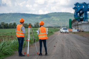
A professional surveyor uses state-of-the-art technology, including GPS and drone photogrammetry, to create an accurate map of the site’s surface. This process ensures that the design of your project is perfectly aligned with the real-world conditions of your land.
Why a Topographical Survey in Pretoria is a Non-Negotiable Step
Engaging a professional for a topographical survey is not just a recommendation; it is a vital part of the planning and development process. Here’s why it’s so important:
- Accurate Planning and Design
Architects and engineers rely on topographical data to create precise designs. The survey provides crucial information on elevation changes, drainage patterns, and the location of existing structures, fences, and utility lines. Without this data, designs could be flawed, leading to costly changes, delays, or even structural issues down the line.
- Ensuring Safety and Compliance
A detailed topo survey helps identify potential site challenges, such as steep slopes or poor drainage areas. This allows engineers to design solutions that mitigate risks and ensure the safety of the final structure. The survey also ensures that your project complies with municipal regulations, preventing legal issues and project setbacks.
- Budget and Cost Management
A precise survey provides the data needed for accurate quantity estimations, such as the amount of earth to be moved during excavation. By knowing the exact volumes of cut and fill, you can better manage your budget and avoid unexpected expenses during the construction phase.
- Facilitating Future Development
A high-quality topographical survey is a long-term asset. The data can be used for future expansions or new projects on the same property. It can also be seamlessly integrated into various software platforms used by other professionals, streamlining communication and collaboration.
The Professional Difference

When it comes to topographical surveys in Pretoria, working with a registered professional land surveyor is key. Their expertise and knowledge of the local area and regulations ensure that your survey is not only accurate but also legally compliant. Using modern equipment, they can quickly and efficiently deliver the precise data you need to move your project forward with confidence.
Contact The Land Surveyor today for a free consultation and quote on your topographical survey. Let our expertise be the foundation of your success.