Understanding the Importance of Cadastral Surveys Before Development
Before beginning any property development project, whether it’s constructing a new home, developing a commercial property, or subdividing land, one of the most important steps is conducting a cadastral survey. Many developers focus on architectural plans, municipal approvals, and budgeting, but overlooking a cadastral survey can lead to costly delays, legal disputes, and compliance issues.
A cadastral survey provides an accurate representation of a property’s legal boundaries and ensures that all development plans align with official land records. It forms the foundation for responsible land development and helps property owners avoid unexpected problems during construction.
At The Land Surveyor, we assist homeowners, developers, architects, engineers, and investors throughout South Africa with professional cadastral surveying services that support successful property developments from the very beginning.
What Is a Cadastral Survey?

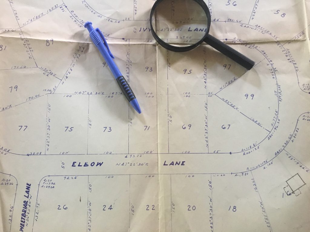
A cadastral survey is a legally recognised survey conducted by a registered land surveyor to determine the precise boundaries, dimensions, and legal description of a property. It establishes the exact location of boundary beacons and produces official survey diagrams used for property registration and land administration.
Unlike general land measurements, cadastral surveys are legally binding and form part of the official records maintained by the Surveyor General and the Deeds Registry.
Cadastral surveys are commonly required for:
- Property development
- Subdivision of land
- Consolidation of properties
- Boundary verification
- Township establishment
- Property transfers
- Servitude registration
- Municipal planning applications
Learn more about our professional land surveying services by visiting:
Why Are Cadastral Surveys Essential Before Development?
Every successful development begins with accurate property information. A cadastral survey ensures that developers know exactly where they can legally build while confirming that the proposed project complies with property boundaries and land regulations.
Without an accurate survey, developers risk constructing buildings outside legal boundaries, leading to expensive corrections or legal action.
1. Confirm Legal Property Boundaries
One of the primary purposes of a cadastral survey is to accurately establish property boundaries.
Property boundaries determine:
- Where construction may take place
- The extent of the land
- Neighbouring property limits
- Municipal setback requirements
- Ownership limits
Many boundary disputes occur because property owners rely on existing fences or walls rather than official survey information.
A cadastral survey removes uncertainty by identifying the property’s true legal boundaries.
2. Support Municipal Development Approvals
Before approving many development applications, municipalities require accurate property information.
A cadastral survey provides essential documentation for:
- Building plan approvals
- Rezoning applications
- Consent use applications
- Subdivision approvals
- Consolidation applications
- Township establishment
Having accurate survey information early in the planning process can significantly reduce approval delays.
3. Prevent Costly Construction Errors
Constructing buildings outside legal boundaries can result in:
- Stop-work orders
- Demolition requirements
- Legal disputes
- Project delays
- Financial losses
A professional cadastral survey ensures architects and contractors work with accurate property dimensions before construction begins.
This proactive approach saves time, money, and unnecessary complications.
4. Facilitate Property Subdivisions
If you’re planning to divide a property into multiple portions, a cadastral survey is legally required.
The survey defines the new property boundaries and creates the survey diagrams needed for registration with the Surveyor General and Deeds Office.
Without a cadastral survey, subdivision applications cannot proceed.
If you’re considering property ownership changes, you may also find this guide useful:
It explains how survey information supports the legal transfer and registration of property ownership.
5. Resolve Boundary Disputes Before They Arise
Neighbour disputes over property boundaries are common, particularly when new developments begin.
A cadastral survey provides legally recognised evidence that helps resolve disagreements regarding:
- Fence locations
- Building encroachments
- Shared access
- Boundary walls
- Property dimensions
Resolving these issues before construction starts helps avoid costly legal proceedings later.
6. Locate Existing Property Beacons
Property beacons identify the official corners of a property.
Over time, beacons may become:
- Buried
- Removed
- Damaged
- Covered during landscaping
- Lost during previous construction
Registered land surveyors use advanced surveying equipment and official records to locate or replace missing beacons, ensuring development begins from accurate reference points.
7. Improve Project Planning
Accurate cadastral information allows developers to design projects that maximise land use while complying with municipal regulations.
Survey data helps with:
- Site planning
- Infrastructure design
- Road access
- Drainage planning
- Utility placement
- Environmental assessments
Better planning reduces project risks and improves overall development efficiency.
The Role of a Professional Land Surveyor
Registered land surveyors provide far more than property measurements. Their expertise ensures that development projects comply with South African property legislation and surveying standards.
Professional surveyors assist with:
- Boundary surveys
- Cadastral surveys
- Subdivision surveys
- Consolidation surveys
- Beacon relocation
- Survey diagrams
- Property development support
Their work provides the legal certainty required for successful development projects.
When Should You Arrange a Cadastral Survey?
A cadastral survey should be completed before:
- Purchasing development land
- Submitting building plans
- Applying for rezoning
- Starting construction
- Subdividing property
- Consolidating land
- Registering servitudes
- Selling development sites
Completing the survey early allows potential issues to be identified and resolved before they delay the project.
For more information about property registration and legal ownership, read:
Property Transfer in South Africa
This guide explains how surveying and legal registration work together to facilitate successful property transactions.
Benefits of Investing in a Cadastral Survey
A professional cadastral survey offers numerous long-term benefits, including:
- Accurate property boundaries
- Legal compliance
- Reduced development risks
- Faster municipal approvals
- Improved project planning
- Prevention of boundary disputes
- Protection of property investments
- Reliable property records
The relatively small investment in professional surveying can prevent significant financial losses later in the development process.
Conclusion

Understanding the importance of cadastral surveys before development is essential for anyone planning to build, subdivide, or develop property in South Africa. A cadastral survey provides the legal certainty needed to ensure your project complies with property boundaries, municipal regulations, and national surveying standards.
By investing in professional surveying services before construction begins, property owners and developers can avoid unnecessary delays, reduce legal risks, and build with confidence.
Whether you’re developing residential, commercial, or agricultural land, The Land Surveyor offers the expertise and precision needed to support every stage of your project.