Property Development Survey in Pretoria: Why Accurate Surveying Matters
Property development is a significant investment, and successful projects depend on careful planning and accurate information. Whether you are developing residential homes, commercial buildings, sectional title properties, or vacant land, understanding the site before construction begins is essential.
A property development survey in Pretoria provides developers with accurate information about boundaries, land levels, existing features, and other important site conditions. This information helps architects, engineers, planners, and contractors make informed decisions throughout the development process.
Without accurate surveying, developers may face boundary disputes, construction errors, planning delays, or unexpected costs. Working with a professional land surveyor at the beginning of a project can help identify potential problems before they become expensive complications.
What Is a Property Development Survey?
A property development survey involves collecting accurate information about a property to support planning, design, approvals, and construction.
Depending on the project, surveying may include:
- Property boundary surveys
- Cadastral surveys
- Topographical surveys
- Construction setting out
- Beacon relocation
- Subdivision surveys
- Consolidation surveys
- Engineering surveys
Each type of survey serves a different purpose, but together they provide developers with a reliable understanding of the land.
For professional land surveying services, visit The Land Surveyor:
https://www.thelandsurveyor.co.za/
Why Do Property Developers Need Professional Surveying?
Property development involves numerous technical and legal requirements. Accurate survey information provides the foundation for making decisions about how land can be used and developed.
1. Establish Accurate Property Boundaries

Before designing a development, you need to know exactly where the property begins and ends.
A professional land surveyor can verify the legal boundaries using cadastral records, survey diagrams, and appropriate surveying equipment.
This is particularly important when:
- Constructing boundary walls
- Developing properties close to neighbours
- Purchasing vacant land
- Subdividing properties
- Planning large developments
Relying on existing fences or walls can be risky because they may not accurately represent the legal property boundary.
2. Understand the Site’s Topography
The physical characteristics of land can have a major impact on development costs and design.
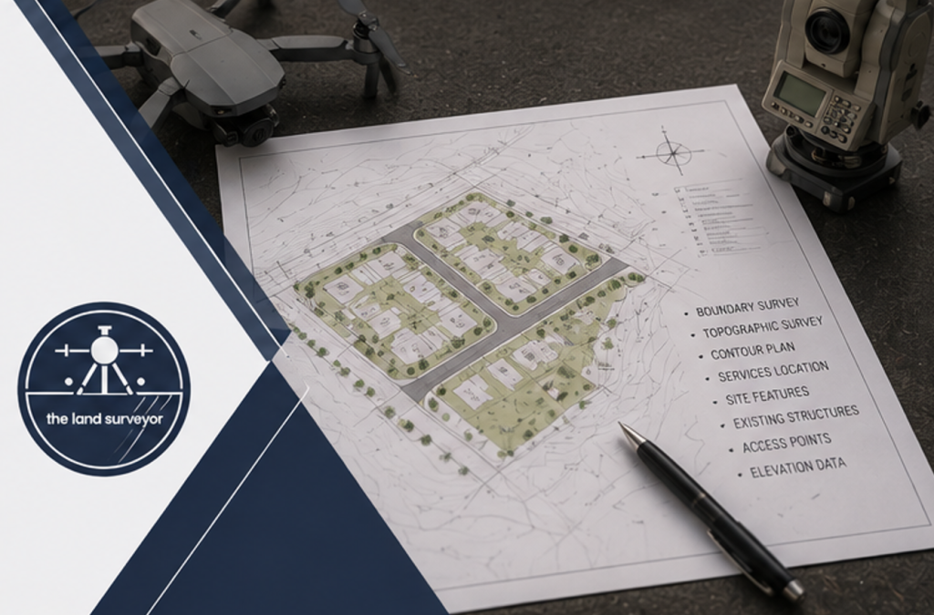
A topographical survey provides information about:
- Ground elevations
- Slopes
- Contours
- Existing buildings
- Roads
- Drainage features
- Trees and vegetation
- Other physical site features
Architects and engineers can use this information to design a development that works with the existing terrain.
For properties with significant changes in elevation, accurate topographical information can be particularly valuable for planning foundations, access roads, stormwater systems, and earthworks.
3. Support Development Planning
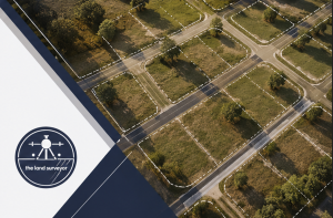
A property development survey provides the technical information required during the early planning stages of a project.
Survey information can assist professionals in determining where buildings, access roads, parking areas, services, and other infrastructure can be positioned.
Accurate measurements can also help identify potential limitations before detailed designs are completed.
This can save developers considerable time and money by reducing the need for major design changes later.
4. Assist With Property Subdivision

Many Pretoria property developments involve subdividing a larger property into smaller portions.
Subdivision requires accurate identification of existing property boundaries and the creation of new legal boundaries.
A professional land surveyor can assist with the surveying aspects of subdivision applications and prepare the necessary survey documentation.
If your project involves changes to property ownership, you can also learn more about the process through:
https://www.thelandsurveyor.co.za/property-ownership-transfer/
5. Help Prevent Construction Errors
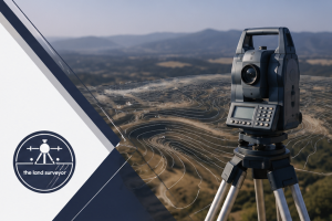
Once development plans have been approved, surveying continues to play an important role during construction.
Construction setting out transfers the positions shown on approved plans onto the actual site.
This helps contractors accurately establish:
- Building corners
- Foundation positions
- Structural grids
- Roads
- Infrastructure
- Other construction elements
Accurate setting out reduces the risk of buildings being constructed in the wrong location.
6. Reduce the Risk of Boundary Disputes
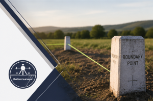
Boundary disputes can become costly and time-consuming, particularly when development or construction is taking place.
A professional property development survey helps establish reliable information about the legal boundaries of the site before construction begins.
This can help prevent disputes relating to:
- Building encroachments
- Boundary walls
- Fences
- Access areas
- Development footprints
Addressing boundary questions before construction is generally far easier than resolving them after structures have been built.
7. Improve Cost and Project Planning
Unexpected site conditions can significantly affect development budgets.
Surveying can identify important site characteristics before construction begins, allowing developers and consultants to plan more accurately.
For example, information about steep terrain, drainage, existing structures, or property boundaries can influence construction methods and costs.
Better information leads to better budgeting and fewer surprises during construction.
What Does a Property Development Survey Include?
There is no single survey that applies to every development. The requirements depend on the size, location, and purpose of the project.
A development may require several types of surveying services.
Cadastral Surveys
These focus on the legal definition and boundaries of properties. They are particularly important for subdivisions, consolidations, and other land registration processes.
Topographical Surveys
These record the physical characteristics and elevation of the land and are commonly used for architectural and engineering design.
Boundary Surveys
These establish the legal limits of a property and can help prevent disputes with neighbouring owners.
Construction Setting Out
This transfers approved design information onto the site so that structures can be constructed in their correct positions.
Beacon Relocation
If existing property beacons are missing, buried, or difficult to locate, a professional surveyor can assist in establishing their correct positions.
When Should You Arrange a Property Development Survey?
Ideally, surveying should be considered before detailed development planning begins.
Early surveying allows developers to understand the property and identify potential problems before committing significant resources to design and construction.
Consider arranging professional surveying when:
- Purchasing land for development
- Planning a residential development
- Developing commercial property
- Subdividing land
- Consolidating properties
- Preparing construction plans
- Planning infrastructure
- Resolving boundary uncertainties
The earlier potential issues are identified, the easier they are to address.
Why Choose a Professional Land Surveyor in Pretoria?
A qualified professional land surveyor has the technical expertise and equipment needed to provide accurate land information for development projects.
Professional surveying can provide:
- Precise measurements
- Reliable property information
- Accurate boundary identification
- Detailed site information
- Support for development planning
- Construction positioning
- Professional survey documentation
Using an experienced surveyor gives developers greater confidence that decisions are based on accurate information.
For additional information about property transfers and surveying, visit:
https://www.thelandsurveyor.co.za/property-transfer-in-south-africa/
Choosing the Right Surveying Partner
When selecting a surveying company for a development project, consider experience, professional registration, technical capabilities, and familiarity with the type of development you are planning.
A good surveying partner should be able to understand the technical requirements of your project and communicate effectively with architects, engineers, planners, attorneys, and contractors.
The right professional can become an important part of your development team from the initial site investigation through to construction.
Conclusion
A property development survey in Pretoria is an important investment for anyone planning to develop land. Accurate surveying provides the information needed to understand property boundaries, site conditions, elevations, and existing features before design and construction begin.
From cadastral and topographical surveys to boundary verification and construction setting out, professional land surveying can reduce project risks, prevent costly errors, and support better decision-making.
Whether you are devhomeeloping a single residential property or undertaking a larger commercial or residential development, accurate survey information should be one of the first considerations in your project.
The Land Surveyor provides professional surveying services to help property owners and developers approach their projects with accurate, reliable land information.